




Kane County Uses July Flood Data to Better Prepare for the Future
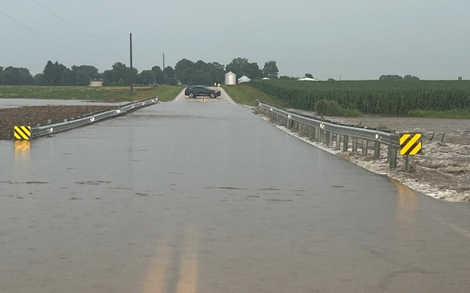
The torrential rains that swept across Kane County over the Fourth of July holiday left flooded roads, washed-out infrastructure and overwhelmed stormwater systems. While residents saw emergency responders and highway crews working around the clock, the Kane County Environmental and Water Resources team was also busy behind the scenes, collecting critical data that will help reduce future flood risks.
During a storm summary presented to the Kane County Board's Development Committee, Rob Linke, Senior Water Resources Engineer and Wetland Specialist with the Kane County Department of Environmental and Water Resources, detailed the extraordinary rainfall that inundated the county over the Fourth of July weekend. In less than 48 hours, portions of Kane County received historic amounts of rain, with Sugar Grove recording nearly 8.5 inches, Aurora more than 8 inches, Batavia 5.5 inches, and Elgin and Gilberts each receiving just over 5 inches. Much of the heaviest rainfall fell across the southern portion of the county within a one- to two-hour period, overwhelming drainage systems and contributing to widespread flooding.
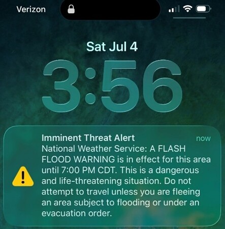
"When we compare the rainfall that weekend to what engineers use for designing drainage infrastructure, about four inches of rain in one hour is considered a one-percent chance event, or what is commonly referred to as a 100-year storm," said Linke. “Most storm sewers and culverts are designed for 10 year to 30 year storm events, so the four-plus inches of rain that fell in one to two hours on the afternoon of July 4th overwhelmed a lot of our community's stormwater infrastructure, which is why the flooding was so bad in some areas."
At one point during the storm, the Kane County Division of Transportation (KDOT) reported that every county road south of Interstate 88 had been overtopped by floodwaters.
One of the hardest-hit locations was County Highway 48 (Scott Road), where floodwaters washed out the roadway at Duffin Drain, a tributary of Welch Creek in the Big Rock Creek Watershed. The road required extensive repairs before reopening on July 28.
While road crews focused on restoring transportation routes, Kane County's Department of Environmental and Water Resources began documenting the flooding.
On July 5, staff visited subdivisions and known flood-prone areas throughout the county to assess damage. Working alongside KDOT, county staff conducted visual inspections, flew drones to capture aerial imagery, and surveyed high-water marks and debris lines using GPS equipment.
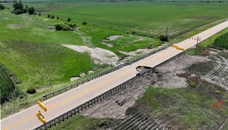
The information collected will be used to improve flood hazard modeling in each of Kane County's watersheds.
A watershed is an area of land where rainfall and snowmelt drain into the same network of creeks, streams and rivers. Understanding how water moved during the July storm will help engineers better predict flooding and plan future drainage improvements.
New Flood Reporting Portal
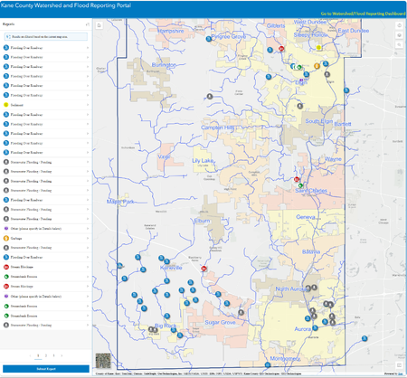
The July storm also highlights the importance of a new Kane County Flood and Watershed Concerns Portal, developed by the Department of Environmental and Water Resources in partnership with the County's GIS Division.
The publicly accessible online tool allows residents, municipalities and other agencies to report flooding, upload photographs and document impacts to roads, bridges and private property. Users can also report debris blockages, illegal dumping, water quality concerns and other watershed issues.
"This site is going to allow us to collect much more information that we can use to update our models and make better decisions when it comes to drainage infrastructure and stormwater management," Linke said.
Historical flood information dating back to the 1990s has already been added to the system, creating a valuable resource for engineers, emergency planners and the public. Reports and data already entered into the portal can be viewed through a Flood Reporting and Watershed Concerns Dashboard where users can query flooding reports by city, watershed, and date.
Preparing for Future Storms
The flood reporting portal is just one of several initiatives Kane County is undertaking to reduce future flood hazards.
Current projects include:
- Installing educational flood-risk signs throughout the county in flood -prone areas near rivers and streams.
- Implementing a pilot project to install a solar-powered flood warning sign along Dauberman Road to alert motorists when floodwaters make travel dangerous.
- Completing a cost-sharing drainage improvement project in Hampshire Township that, according to nearby residents, successfully prevented flooding during the July storm.
- The Kane County Flood Study Initiative, in which the County is taking the lead on creating high-resolution watershed scale flood models to better identify flood risks across all of Kane County.
Residents and business owners are encouraged to use the Flood and Watershed Reporting Portal to report flooding and share photos following major storm events. The information helps engineers improve flood models, prioritize infrastructure projects and strengthen Kane County's ability to prepare for future severe weather.
To learn more or submit a flood report, visit the Kane County Flood and Watershed Concerns Portal