




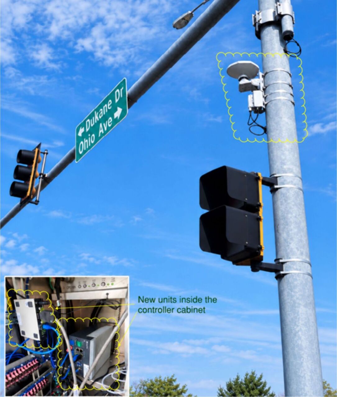
New LiDAR Technology Comes to a Kane County Intersection
What is new at the intersection of Kirk Road and Ohio Street in St. Charles?
Kane County is testing a new vehicle-detection system that uses LiDAR technology. It is the first time the technology is being tested at a Kane County intersection and is believed to be new to the Chicagoland area.
What is LiDAR?
LiDAR stands for Light Detection and Ranging. It uses pulses of laser light to measure distances and create a precise, three-dimensional map of objects around and approaching the intersection.
How is it different from traditional vehicle detection?
Many County intersections use video cameras to detect vehicles, which has performed well overall. But LiDAR uses laser technology instead, making it less susceptible to problems such as winter salt spray and sun glare that can sometimes interfere with video detection.
Does the system track individual vehicles?
No. The system does not identify license plates or track specific vehicles. It detects the presence or absence of vehicles and pedestrians and can provide an accurate count of traffic moving through the intersection.
What can the county learn from the system?
The technology can provide detailed information about the number of vehicles and pedestrians using the intersection, helping the County better understand traffic patterns.
How many units are needed?
Two LiDAR units can cover an entire intersection.
How much does the technology cost?
The total cost for the LiDAR detection system is approximately $32,000, compared with approximately $38,000 for a video detection system covering the entire intersection.
Why is Kane County testing LiDAR now?
The Kirk Road concrete patching project disrupted the existing pavement sensors at the intersection. Rather than spending money to restore the older detection system (inductive wire loops cut into the pavement surface), the county invested slightly more to test the newer LiDAR technology. The existing wire loops are simply abandoned in place and using the LiDAR equipment saved the pavement surface from more sawcuts.
What happens next?
Kane County will evaluate how the system performs under real-world conditions and determine whether LiDAR could be useful at other intersections in the future. Evaluating and testing leading-edge technology devices in the field before full-scale deployment is an industry-standard practice. KDOT will share its operational experience, testing data, and lessons learned with IDOT and other County DOTs to help avoid redundant spending and ensure that public infrastructure investments provide measurable safety and operational efficiency benefits.
Learn more about the programs and projects at KDOT at https://kdot.kanecountyil.gov/Pages/Default.aspx